Emergency Aerial Mapping
-

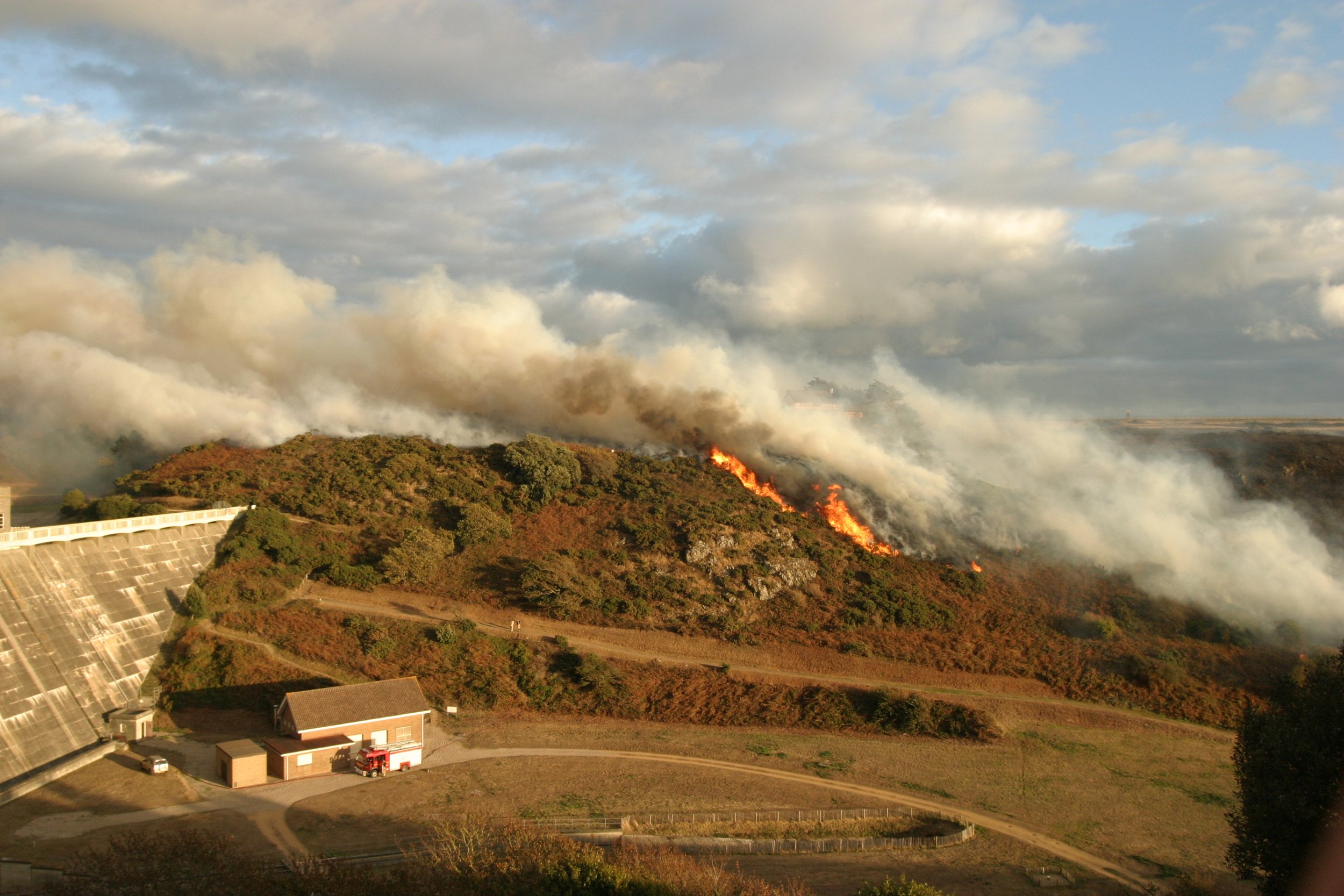
2D Sitrep
The ability to rapidly generate and share a 2D aerial image of a scene provides incident commanders on the ground and in the control room with greater situational awareness and with staged flights, how a scene develops over time.
-

2D Hazard Identification
Using software from Drone Deploy we can fly over a scene, generate an overhead image, share online and allow others to study the site, highlighting hazards, counting items, and flag areas that need further investigation whether it be by people on the ground or the drone pilot.
-

3D Terrain Profiling
3D scene mapping enables centimetre-accurate terrain profiling showing factors such as cross-section profile, steepness of terrain and distance both direct and over the surface. We aim to pre-survey the coastlines of all islands over time, enabling instant access to terrain data.
-

3D Scene Recreation
Within 15 minutes of arriving on scene, we are able to take imagery enabling a centimetre accurate detailed 3D scene recreation for evidence or training purposes. For large incidents we can easily and safely map a scene over time documenting the changing nature of the incident.
Partnering with local businesses
Whilst we don’t operate a full commercial service, we partner with a few local companies who support our emergency drone team financially and provide us with sites and survey tasks throughout the year for our pilot training. We also make some of our survey equipment inventory available to rent which enables us to fund some of our training.
-

Aerial Surveys
Working with commercial partners gives our emergency pilots a range of training locations and varied experience with pre-flight planning, risk assessments and flying in areas they may not be familiar with.
-

Traffic Surveys
Our tethered drone is the perfect platform for traffic monitoring due to its unlimited flight time. We feed the video through specialist software that produces detailed reports.
-

Solar Inspections
Thermal Imaging can be used to survey solar panels, verifying they are operating at maximum efficiency and there are no panel failures. For our pilots, this provides good training working with thermal vision.
Equipment used for aerial surveying
-
DJI Mavic 3 Enterprise
DJI Mavic 3 Multispectral
Fotokite Sigma -
DJI D-RTK 2
Emlid Reach RS2+
Emlid Reach RX -
DJI Terra
DJI Thermal Analysis
Drone Deploy
Pix 4D React
Autodesk Construction Cloud
Emlid NTRIP caster